Borobudur At Glance
The Ancient Sacred Building
 |
| Buddha statue seated in a stupa. Source: Guiding Technique Chandi Borobudur arisguide. Foto screenshot arisguide. |
 |
| Sacred Buddhist Temple Source: Guiding Technique Chandi Borobudur arisguide. Foto arisguide. |
 |
| Stupa terraces Source: Guiding Technique Chandi Borobudur arisguide. Foto screenshot arisguide. |
The central dome is surrounded by 72 Buddha statues, each seated inside a perforated stupa.
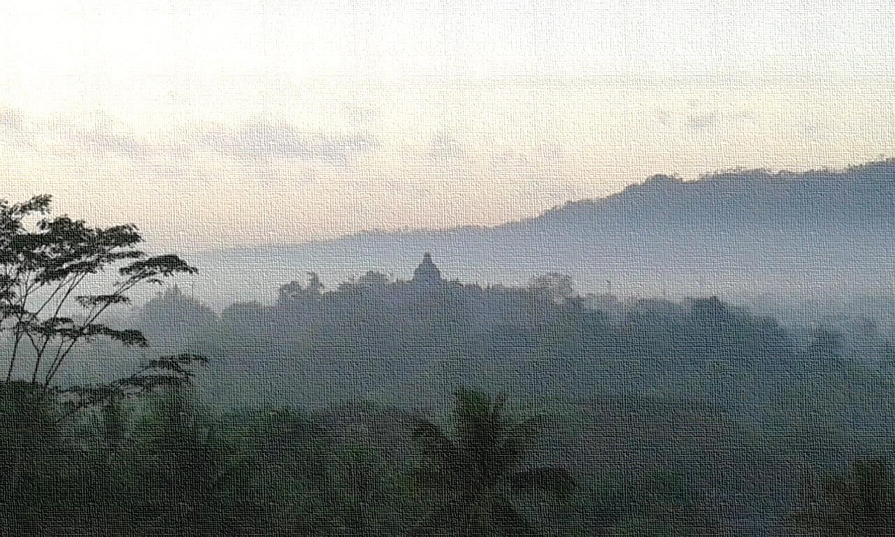 |
| Borobudur views from Bukit Dagi Source: Guiding Technique Chandi Borobudur arisguide. Foto arisguide |
 |
| Borobudur World Heritage Source: Guiding Technique Chandi Borobudur arisguide. Foto screenshot arisguide. |
 |
| Source: Guiding Technique Chandi Borobudur arisguide. Foto screenshot arisguide. |
 |
| Perforated stupas Source: Guiding Technique Chandi Borobudur arisguide. Foto screenshot arisguide. |
Arrested by the slopes of the southern ridge of the plain the two rivers flow together, after which the Progo carries the waters to the ocean along side the southward - bending Menoreh range.
The area around the confluence of the Progo and the Elo rivers was in ancient times a holy place of particular significance. A considerable number of the Kedu plain monuments were founded here. Hindu and Buddhist sanctuaries were packed together within a radius of less than three kilometers from the point where the two Kedu rivers meet. From west to east, the main Buddhist monuments of the area are: Chandi Borobudur, Chandi Pawon, Chandi Mendut, and the Chandi Ngawe compound which consists of five structures.
The first three sanctuaries are assumed to have formed one compound also; though standing at a considerable distance from each other, a straight line drawn from Chandi Borobudur to Chandi Mendut through Chandi Pawon suggests the unity of the triad. This kind of lay - out is not to be found at Borobudur.
 |
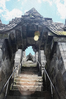
| the processional path Source: Guiding Technique Chandi Borobudur arisguide. Foto screenshot arisguide. |
According to oral tradition the triad was once linked by a paved processional path, flanked by richly decorated balustrades. The exceptional composition of the triad has led to much speculation about the relation between Chandi Borobudur, Chandi Pawon and Chandi Mendut. The most plausible link is religious, if the denomination ‘compound’ is interpreted in a particular way; the three monuments can be taken as a whole to represent one religious conception. Chandi Borobudur has no inner space, no place where devotees could worship. Most likely it is a place of pilgrimage, where Buddhists can seek after the Highest Wisdom.
The passages all around the edifice, successively mounting to the upper most terraces, are evidently meant for ritual circumambulations. Guided and instructed by the narrative reliefs, the pilgrim proceeds from one terrace to another in silent contemplation. Chandi Mendut is seemed a place of worship. The Buddha is represented by a formidable monolith, seated with hanging legs on a throne and flanked by the accompanying Boddhisattvas Avalokitesvara and Vajrapani. The depiction of the Buddha preaching the first sermon in the deer - park at Sarnath is apparently meant to recall right conduct in life to those who seek their refuge in the Compassionate Buddha.
The small Chandi Pawon also has an inner space, but it does not reveal what deity might have been the object of worship. It is impossible to say what was the function of the temple in relation to Chandi Mendut or to Chandi Borobudur?.
 |
| The Buddha statue Source: Guiding Technique Chandi Borobudur arisguide. Foto arisguide. |
The pilgrim had to pass Chandi Pawon as his way from Chandi Mendut to Chandi Borobudur along the paved processional path might suggest that Chandi Pawon was a kind of station on the long journey; after being purified through the required ceremonies of worship at Chandi Mendut, Chandi Pawon allowed to pause and reflect before proceeding on the pilgrimage to Chandi Borobudur where attire some series of circumambulations awaited.
 |
| Straight - line arrangement of Chandi Mendut is some three kilometres from Chandi Borobudur, while Chandi Pawon is half that distance away. Source: Guiding Technique Chandi Borobudur arisguide. Image screenshot arisguide. |
Chandi Borobudur originally represented a lotus flower floating on the surface of the lake, the mythical lotus from which the future Buddha will be born.
 |
| Borobudur ancient lake Source: Guiding Technique Chandi Borobudur arisguide. Image screenshot arisguide. |
The popular belief in the existence of a processional path does not tally with the hypothesis, put forward by Nieuwenkamp in 1931, that the Kedu plain was once a huge lake. This idea was based on his discovery that the ground-plan of the monument depicted a lotus rosette and petal around a circular flower-bed, while its situation on top of a hill suggested a lotus floating in the air.
 |
| The color of the lake Source: Guiding Technique Chandi Borobudur arisguide. Foto arisguide. |


Comments
Post a Comment